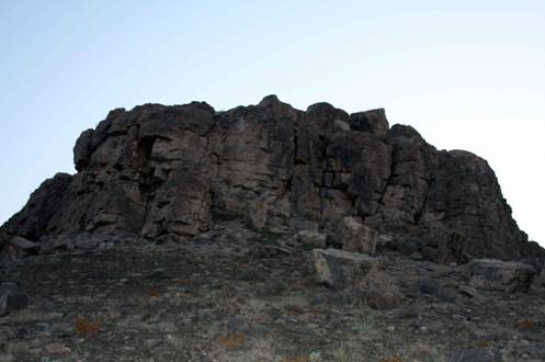
The southern side of Oğlanqala is marked by several stone walls, probably the remains of private houses and other buildings from the Late Iron Age (Achaemenid period). These houses are located immediately north of the Southern Tower (Figure 1). In 2008, we decided to excavate a 2.5X2.5 m sounding (Op. C) in this area in order to retrieve a ceramic and radiocarbon sequence from this area. Since there was little Medieval pottery or architecture in this area, we expected to retrieve a long Iron Age sequence. We excavated the sounding to the depth of 4m, at which point due to safety and time constraints we decided to finish the excavation before encountering virgin soil. The excavation at Op. C thus illustrates that unlike many fortress sites in the Caucasus, Oğlanqala has a well-stratified Iron Age sequence.
Phase 1: Burials
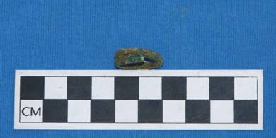
The latest phase excavated contained four fragmentary burials, all of which contained no or very few objects and probably dated to the last few centuries. One of these, Burial #1 (Figure 2), was delineated by rectangular stones, 10-15 cm in length, and contained a bronze ring (Figure 3). The poor-quality, and highly fragmentary bone in Burial #1 do not suggest any particular orientation of the body, though the stone may suggest an east-to-west orientation. Another burial, Burial #3 was discovered near the North baulk under two layers of large stones, both arranged in an oblong and oval pattern. A die or bead was discovered with this burial. The best preserved burial, Burial #4, was discovered inside a stone cist. The body of this individual faced northwest, while the general orientation of the body was running from W to E. No objects were discovered with this skeleton.
Phase 2: Houses
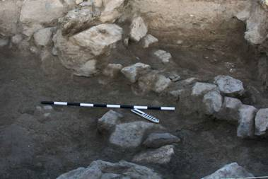
The modern burials had partially disturbed a late Iron Age room, defined by a stone wall, Wall A, which runs SW to NE diagonally across the square, defining two areas within the square. Wall A was built of rectangular stones that were only roughly worked (Figure 4). This wall was preserved to a height of 1m and had three plastered mudbrick surfaces associated with it which had been carefully cleaned before this area was abandoned. The area outside of Wall A was probably a courtyard with a pebbled floor. The courtyard contained some Late Iron Age pottery sherds as well as animal bones and ash rich in botanical remains. Although no built architecture was recovered below Wall A, the next meter represented several floors with associated hearths.
Phase 3: Fortification Wall
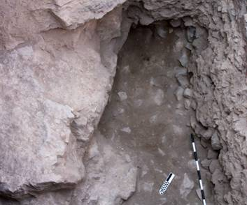
The last phase uncovered during this excavation consisted of a layer of smallish stones and fill above a layer of large stones and fill (Figure 5). The excavators were unable to reach the bottom of the large, rocky layer due to the practical limitations of the excavation season; the excavated portion was up to 1 meter deep in places, and the stones were 30-50 cm large. Some Late Iron Age pottery sherds and ash were mixed in with these stones. The excavators hypothesize that this phase represents a massive fortification wall. The size and extent of this wall is unclear due to the small size of the square, but these stony layers are present in all corners of the square. The last stages of excavation exposed more bedrock suggesting that the rocky layer may have taken advantage of the natural topography of the hill as its foundation.