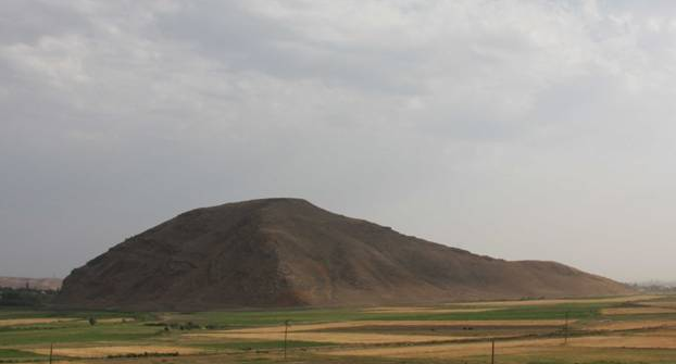
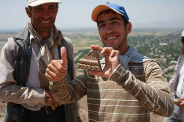
In 2008, the Naxçıvan Archaeological Project began the first season of intensive survey and excavation at the site of Oğlanqala, Azerbaijan in order to investigate economic and political imperialism and its effects on local communities in Naxçıvan during the Iron Age (ca. 500-330 BC) (Figure 1). Oğlanqala probably served as the center of a local polity in the early and middle Iron Age and later became incorporated into the northern frontiers of the Achaemenid Empire. The area offers, therefore, an extraordinary opportunity to investigate the Achaemenid Empire and its imperial and economic strategies.
The Archaeology of Empires
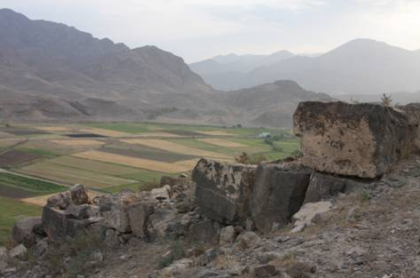
Scholars recognize the Achaemenid Empire as the apogee of Ancient Near Eastern imperialism and as a model for later Mediterranean and Middle Eastern empires, including the Seleucid Empire, Rome, Sassanian Persia and the ‘Abbasid Caliphate (Figure 2). Despite the importance of the Achaemenid Empire in defining ancient imperialism, the archaeology of this empire outside its western Iranian heartland is still in its infancy. Until recently, archaeologists had found little recognizably Achaemenid material across this empire, leading some scholars to question its very existence. Excavations in Iran, Anatolia, the Caucasus and Central Asia during the last twenty years provided new data affirming the existence and extent of the empire, but its imperial nature and the reasons for its ephemeral impact still await analysis. How did imperial Achaemenid centers interact with local populations? How did imperialization change the production and consumption of wealth? How did local elites negotiate power in a new imperial framework?
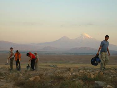
Over the next three years, researchers will test four models of local and imperial interaction to understand the nature of Achaemenid imperialism at Oğlanqala. We will excavate Achaemenid and pre-Achaemenid levels and use multiple instrument geophysical survey, satellite imagery analysis, surface survey, archaeobotany, zooarchaeology, soil micromorphology, ceramic analysis and 3D GIS construction in order to investigate the nature of imperialism at Oğlanqala. Research will examine how imperialism transformed the use of space at this provincial center and in the surrounding plains and will define the economic and cultural impact of imperialism by analyzing how imperialism affected ceramic and agricultural production, consumption and distribution at Oğlanqala. All data from surveys, excavations, and analyses will be incorporated into a three-dimensional GIS to help investigators connect their research across disciplines, and to create a broad understanding of the relationship between space, political power and economic production at a range of scales.
Site Survey
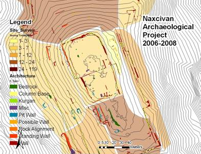
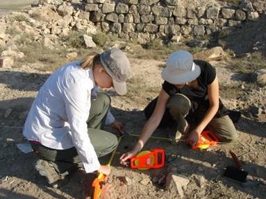
Our first priority for the 2008 season was to understand the nature of the occupation of the site through survey. Robert Bryant (GSU) made a topographic map of Karatepe and recorded the location of all of the standing architecture using a total station (Figure 3). This information was then incorporated into the site GIS and combined with information retrieved from systematic surface collection. As a result, we can look at changing intensity of occupation and use of space from the early Iron Age to the Medieval period at Oğlanqala. In 2009, we plan to use geophysical survey to retrieve more information about the subsurface remains at Oğlanqala.
Oğlanqala Citadel
Our second priority was to investigate the nature of political power at the site. An ancient citadel—the palace/administrative building at the heart of this site—is located on the northern part of the mound, covering an area of 50 X 90m (Figure 4). In 1988-1989, Veli Bakhshaliyev excavated a 280m2 sounding within this citadel, uncovering part of the Achaemenid and earlier Iron Age palaces. This excavation documented four levels: an ephemeral squatter occupation with no built architecture dating to the Hellenistic period (ca. 3rd-1st century BC), two phases of a fortified palace probably dating to the Achaemenid period, and the earliest phase of the site which dates to the Middle Iron Age (Bahşaliyev 1994).
In 2008, we returned to the citadel and opened up three excavation squares (Op. A, Op. B and Op. D) in order to better understand the construction history of this area (Figure 5).
We discovered fragments of several stone columns, perhaps suggesting that this is a large columned hall during the Achaemenid period. Three pottery sherds—inscribed with cuneiform—link the Middle Iron Age occupation of this citadel with fortresses at Bastam in Iranian Azerbaijan and Ayanis in Eastern Turkey (Figure 6).
Achaemenid Houses
Our final goal for the 2008 season was to investigate the relationship of this administrative center with the rest of the site. The dense scatter of pottery and presence of many small stone walls south and east of the citadel led us to hypothesize the presence of private houses in this area. We opened up a small 2.5 X 2.5 m trench in the southernmost part of the site (Figure 7). This deep sounding gave us an opportunity to investigate the use of space in a domestic quarter during the late Iron Age. The 4 m deep Op. C—along with the 5 m deep Op. D on the citadel-- also provided us with a well-stratified sequence of radiocarbon dates and associated ceramics that provides the groundwork for later work at the site.
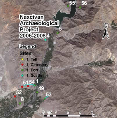
In 2009 and 2010 we will return to Oğlanqala and open up large horizontal excavations in the citadel area and in the “Achaemenid Houses” area in the southwestern part of the site. The research team will also survey the area surrounding Oğlanqala in order to understand the relationship between this site and its larger political environment (Figure 8). We will map four fortress sites located immediately north of Oğlanqala along the Arpaçay and also investigate a series of walls linked to these fortresses that traverse the countryside.
In addition to our survey and excavation plans, NAP will incorporate a broad range of scientists in order to use archaeobotany, zooarchaeology and soil micromorphology in order to understand the relationships of production and consumption in this area.